Three Gorges reservoir on high alert for geological risks
2026-07-25 18:07:52
By Yan Wanqin.
Seasonal flooding and extreme heat are converging over the Yangtze River. Authorities have stepped up geological disaster prevention efforts across the Three Gorges reservoir area. A multilayered monitoring network has been deployed to protect navigation safety along stretches prone to landslides and rockfalls.
The Yichang Maritime Safety Administration has mobilized patrol vessels and drones to monitor shoreline conditions along the reservoir's most vulnerable sections, including the key hazard zones of Muyubao and Micangkou in Guizhou Town, Zigui County.
The authority is also working with geological experts to assess the risks of secondary disasters triggered by extreme weather and implement preventive measures.
Seasonal flooding and extreme heat are converging over the Yangtze River. Authorities have stepped up geological disaster prevention efforts across the Three Gorges reservoir area. A multilayered monitoring network has been deployed to protect navigation safety along stretches prone to landslides and rockfalls.
The Yichang Maritime Safety Administration has mobilized patrol vessels and drones to monitor shoreline conditions along the reservoir's most vulnerable sections, including the key hazard zones of Muyubao and Micangkou in Guizhou Town, Zigui County.
The authority is also working with geological experts to assess the risks of secondary disasters triggered by extreme weather and implement preventive measures.
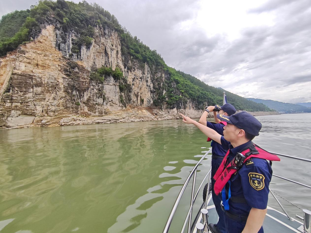
Maritime safety inspectors patrol the riverbank.
Throughout the flood season, the maritime authority shares monitoring and early warning data with meteorological and geological departments daily. Navigation advisories are issued before extreme weather events, creating a closed-loop warning system that links conditions on land with what moves on the water.
At its traffic management center, Yichang Maritime has dedicated monitoring screens exclusively for geologically hazardous waters, providing 24-hour surveillance of shoreline conditions. Ships transiting these sections are alerted via text message, telephone, and VHF radio to keep a safe distance from riverbanks and pass through promptly.
Drones are deployed for aerial inspections to eliminate blind spots, ensuring that any signs of shifting slopes or falling rocks are detected, reported, and addressed without delay.
The maritime authority advises vessels in the river sections near Badong County and Guizhou Town to exercise extra caution, as bank landslides and rockfalls pose significant hazards. Mariners are advised to monitor weather and geological alerts closely, maintain sharp lookouts, keep clear of steep banks, and refrain from anchoring in danger zones. In the event of sudden rockfalls or landslides, mariners should call the maritime rescue hotline at 12395.