Drones deployed to monitor Three Gorges Reservoir
2026-10-24 18:10:39
By Ma Yuanchen
The Changjiang Yichang Waterway Bureau deployed drones to monitor navigation during the Three Gorges Reservoir’s impoundment period, as the water level rose to its normal level of 175 meters on October 22. Rising water levels and complex navigation conditions create risks along the reservoir’s waterways. The drone network helped ensure safe and smooth water traffic throughout the process.
The bureau used low-altitude drones and its smart platform for patrols, covering high-risk waters and 60 geological hazard sites across the reservoir. Patrols tracked vessel movements, navigation markers, and surrounding water conditions with high precision. Drones flew close to sites once anomalies appeared and livestreamed video feeds to command teams. Operators launched, routed, and coordinated drones through a unified control system.
“In the past, a boat patrol of the Nanmuyuan hazard site took at least an hour,” said Ma Suiyang, director of the Waterway Operations Section at the bureau. “Drones can launch in 10 seconds and complete the same patrol within 10 minutes.”
Drone footage and video feeds connect to the digital waterway platform at the command center. This system creates a three-tier monitoring network combining air patrols, digital checks, and on-site boat inspections. During the impoundment period, drones completed 26 patrol missions with 250 minutes of total flight time. Drone patrols run more than 50 percent faster than conventional boat cruises. The operation delivers broader data coverage and faster emergency response.
The bureau also stationed emergency staff on duty during this critical period. The large tugboat Yigongjiao 2 remained on standby in the waters of Zigui for emergency incidents.
Wang Ying and Yang Yi also contributed to this story.
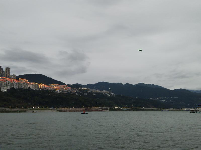
Drones carry out aerial patrols over the Three Gorges Reservoir.